All photos by Barbara Matthews

Wednesday, November 12, 2014

My Walk in the Woods

Fall is my favorite time of year. I was lucky enough to get a few photos at 
Empire Mine State Historic Park today before the incoming storm hits. 
I am so fortunate to have several California State Parks nearby
 and I get out and enjoy them as often as possible. Empire Mine has the 
mine property and museum but also has miles of trails that are accessible for free.
It is really sort of a maze of interlocking and looping trails, none of them 
very long in mileage. The various loops can be connected to
 make a very nice 5 mile +/- hike through the woods. 

Here is a panorama of one of the intersections, 
my favorite bridge and some beautiful fall colors.
Click the photo to see full size image!


Saturday, September 27, 2014

Panoramas from along the trail


Panoramas from along the Duck Pass and John Muir Trails
Click on photo for the best view

Heading up Duck Pass
Looking back a the trail hiked and lakes visited


Duck Lake and Pika Lake
At close to 10,800 ft elevation, this lake will take your breath away


Duck Lake from the outlet
This area is closed to camping, but makes a great rest stop 
before continuing on to the John Muir Trail


Sweeping views from along the John Muir Trail


Hiking through the remnants of the Rainbow Fire 
heading down into Red's Meadow

Sunday, September 21, 2014

2014 John Muir Trail section hike recap

What a beautiful hike and an incredible learning experience.
As a shakedown prep hike for our AT thru-hike next year,
this hike was a success despite having to cut it short. Check out my
journal here

Here are some of my favorite scenes from along the way.
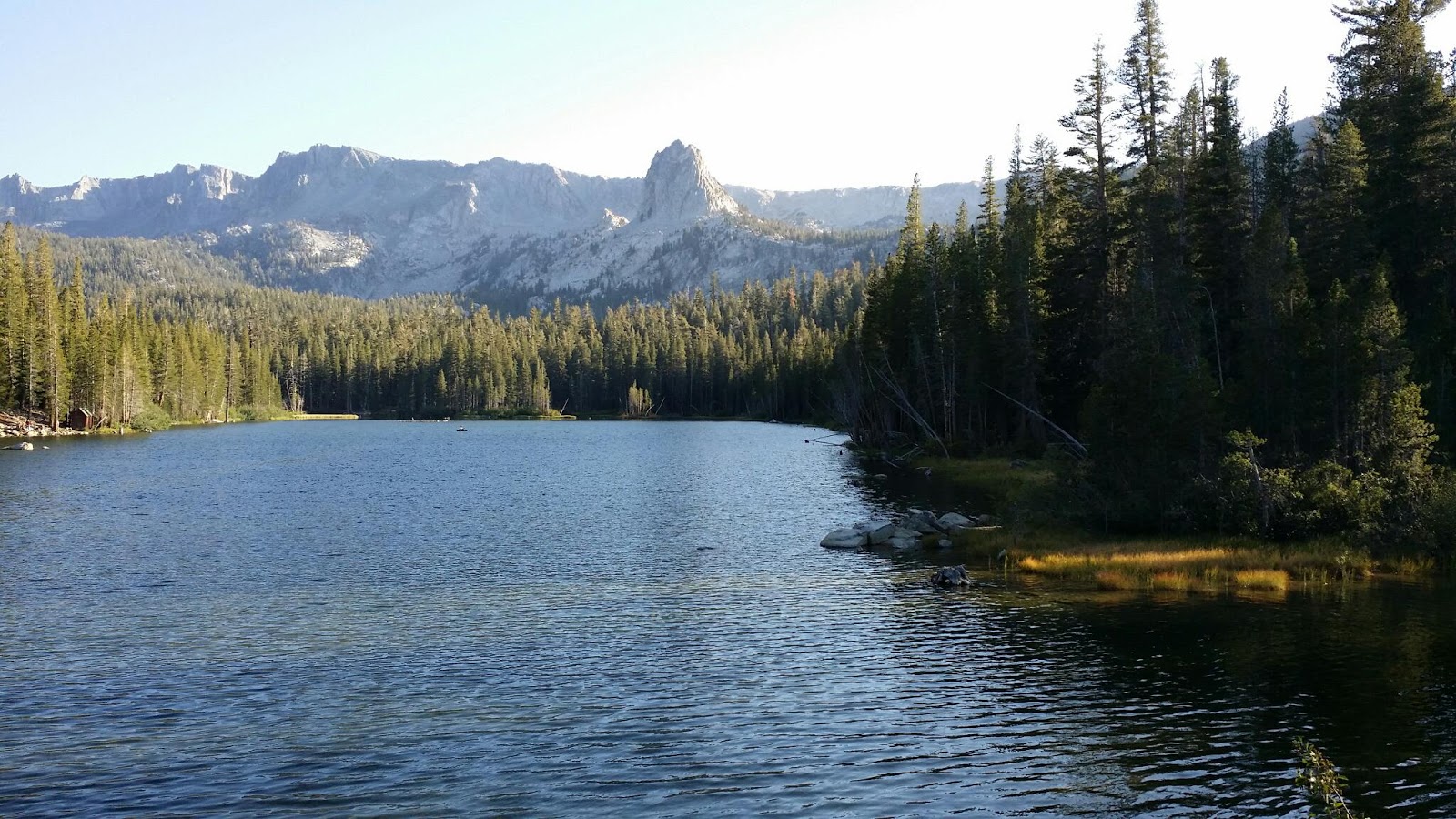

Lake Maime Sunset 
A day to get acclimated


Cole heading up the Duck Pass Trail into the John Muir Wilderness


The journey up the mountain begins


Enchanted- Arrowhead Lake
A beautiful spot to stop for breakfast, just .3 miles down a side trail. 
The scene quickly turned magical as the sun rose higher.


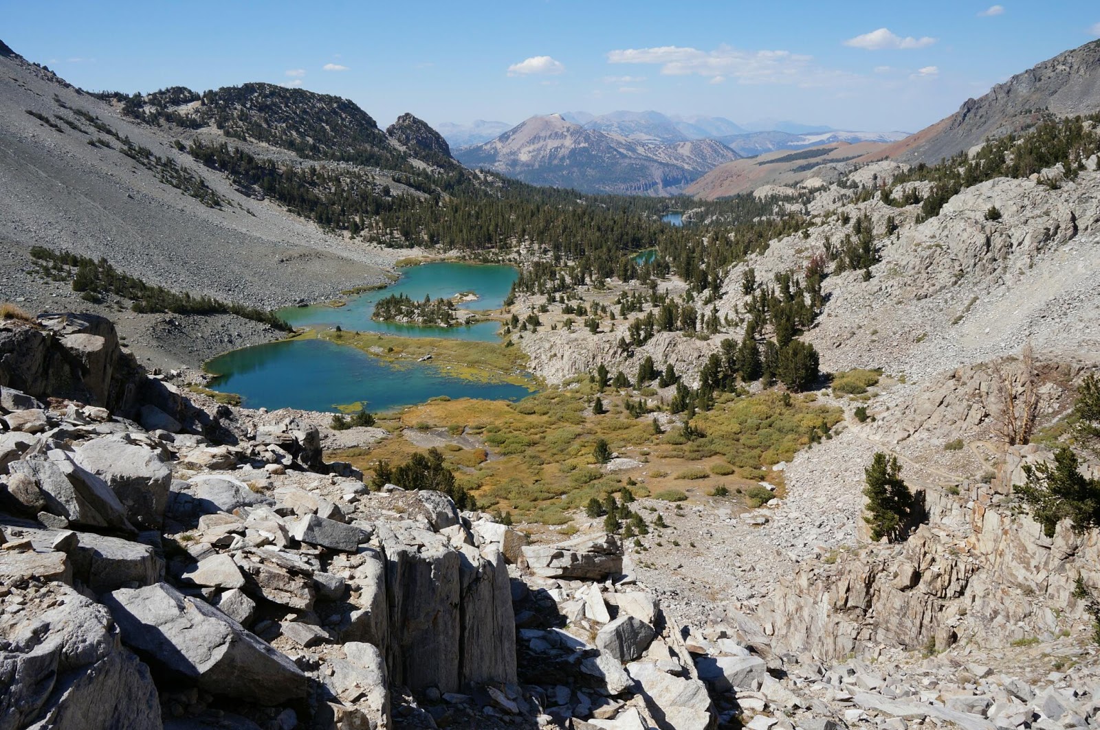
A sandy beach at Skeleton Lake


Further up the trail we got a great view of Skeleton Lake


Lunch break on the rocky shore of Barney Lake.


Resting at Barney Lake


Lunch and rest at Barney Lake before the switchbacks climbing up Duck Pass.


Hot and dry switchbacks provided little shade but stunning views of the 
trail we have already traveled.


Barney Lake from above


Cole taking in the view


Up and over Duck Pass


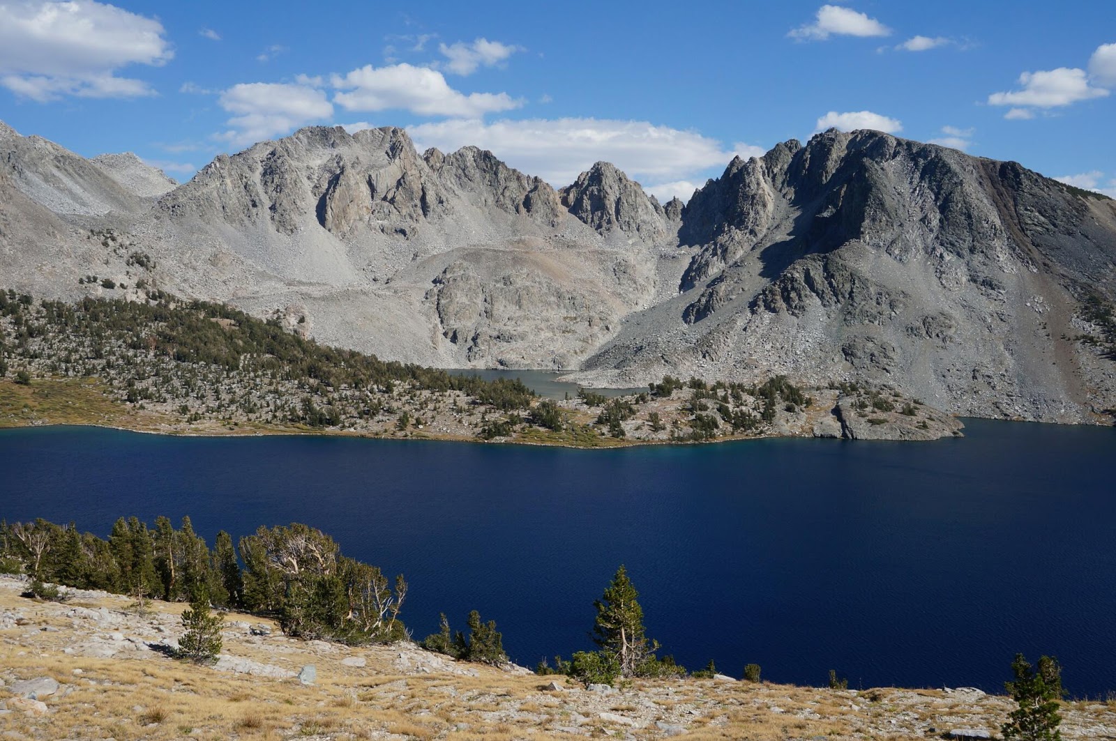
Duck Lake and its smaller neighbor Pike Lake


Duck Lake Outlet heading toward the junction of Duck Pass Trail and John Muir Trail


A familiar scene as my son Cole takes a break while waiting for me to catch up.


Panorama of Duck Lake from the outlet


Duck Lake and smaller Pika Lake


First full day on the John Muir Trail


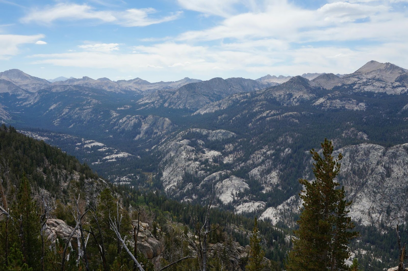
Incredible vistas along the JMT heading north towards Red Cones


We met several Southbound JMT thru-hikers during the day. A friendly Brit took a photo for us.


Crater Meadows area along the John Muir Trail


Yet another tortoise and the hare scene. The trail has transformed into crushed pumice, dusty and similar to walking through sand.


An old giant


One of the Red Cones


The next morning, we traversed through devastation on a scale the photos just don't show.
A windstorm with sustained winds of 150 mph tore through this area in November of 2011
snapping off and uprooting thousands of trees. Kudos to the trail crews that tackled the tremendous task of clearing the downed trees from the trail. 


A few miles down the trail, the scene shifts from blow down to fire scars. The area around Red's Meadow was burned by the 1992 Rainbow Fire. There are many birds, hawks, ferns and wildflowers as evidence of the slow recovery.


Cole's home away from home- Big Agnes Copper Spur 2 and his Helinox Chair


My home away from home= Sierra Designs Lightning 2UL


Rainbow Fire Remnants


The final step. This was the end of our journey as my knees refused to ascend those stairs. 
l

Sunday, July 27, 2014

Under the Stars

I took a spur of the moment camping trip to Hope Valley , CA
to enjoy some cool High Sierra air and dark skies for star gazing.


~High Sierra Heavens~
7 image panorama of the night sky above Hope Valley, CA


~Star Struck~
Dark skies at high altitude are absolutely captivating


~Good Morning Hope Valley~
Sunrise was equally magical

Tuesday, July 22, 2014

Another training hike

Exploring more trails and lakes in the Tahoe National Forest. Testing out S pen for Journal writing , Note 3 for photos and Blogger App for updating along the AT next year .This photo is of where we ended up while searching for a detour around the PG +E water release that we could not cross.

Monday, July 7, 2014

Training Hike-Loch Leven Lakes Trail

Loch Leven Lakes Trail
Tahoe National Forest
Sierra Nevada, CA

For the 4th of July my son and I decided to try out a new trail, the Loch Leven Lakes trail in the Sierra Nevada near Donner Summit. Beautiful views along the way and lovely lakes at our destination. We also added our loaded packs to the routine.The lakes are beautiful! A short but steep hike of only 2.5 miles to the first lake followed by a short and steep hike back out on the same trail. 

Here is a look at trail conditions. In one word, rocks-big, small, loose, and slabs.  I saw many folks with dogs of all sizes on the trail. Be aware that the relatively short distance is deceiving. We were traveling with loaded packs, since this was a training hike for us, so obviously it took us longer than the average day hiker. It took 2 hours 40 minutes to go up and close to the same time to go down. Allow plenty of time to enjoy the beautiful lakes. There are a few brushy areas of trail but at an altitude above 6000 ft ticks and poison oak were not a worry. Be on the lookout for rattlesnakes though. We started at the trailhead at 8 am so the hike up was warm but not too hot. It was in the 80's and sunny on the way down. It is very exposed and very dry so come prepared with plenty of water and sunscreen. I had 3 liters of water just for me and I drank it all. Be aware that the railroad tracks are very active and some of those trains are going pretty fast. I would advise keeping a hold of  dogs and kids once you cross the bridge just to be safe. Plenty of nice camping spots up there, fire restrictions are in force and you need a free "campfire permit" if you plan on using any type of camp stove, campfires are not permitted.


Our destination was only 2.5 miles in so it should have been pretty easy. It turned out to be pretty challenging for me. The hike was pretty much steep rocky uphill, strenuous and fun. The only trouble I had hiking in was the occasional steep step up on big boulders. I can not just simply take a big step up at this point, the useful range of motion for my knees needs improvement. So it was a good opportunity to figure out what works for me when it comes to climbing up. I don't think I would have made it without trekking poles, they are a knee saver! I was thrilled that I had no hot spots or signs of blisters. My backpack with 25 lbs in it rode comfortably on my back, the only place I noticed the weight at all was in my leg muscles and knees.

The trip back down that steep trail was a bit more challenging. We were on a time frame because my son had to get to work. First of all, the steep downhills were tough on the knees, trekking poles were handy to defer some of the downward force though. Climbing over and down some of the larger rocks required figuring out a different method. I found that side stepping down or backing down was a good alternative for some of those big step downs, and for the really challenging ones there was no choice but to sit down and slide down. I walked in a switchback pattern going down some of the slabs of granite, that seemed to help take the pressure off my knees too. I don't feel nearly as surefooted as I did prior to the knee surgeries. By the time we reached the car my knees felt like they were on fire. At home some ice and ibuprofen helped.

It was a great way to spend the 4th and a very useful training hike to identify some areas I need to focus on, especially balance and knee/leg strength. I've got 249 days left to work on it.   

"In every walk with nature one receives far more than he seeks." - John Muir


The start of the hike to Loch Leven Lakes


Typical trail bed, rocks of all sizes, a test for the knees


Trail weaves through open granite and glacial erratics. It can be easy to lose the trail in a few places especially when coming back down to the trailhead.  Keep a look out for rock cairns which are the only trail indicators. Beware of side trails that disappear off steep ledges. 


Granite slabs were easier going up than coming down. Beautiful sweeping views too.


The first pond is not one of the lakes, and a but provides a brief level spot. On the way back we rested here for a few minutes and witnessed a tree spontaneously fall on the far side of the lake. 


Cole "Whitehawk" crests the first ridge line and celebrates the view.


Areas of the trail had many rocks and roots that required focusing on footing.


The foot bridge indicates nearing the railroad crossing. 


Railroad Crossing, keep and eye out for fast moving trains. 


A series of long switchbacks made walking a bit easier.


Lower Loch Leven Lake. Plenty of nice campsites, check with Tahoe National Forest for current regulations and permits.


Another view of Lower Loch Leven Lake