
All photos by Barbara Matthews

All photographs are licensed under a Creative Commons Attribution-NonCommercial-NoDerivs 3.0 Unported License.
Wednesday, July 11, 2018
Fawns
I have been fortunate to see a pair of fawns most days while I am out on a walk. Though I have been busy with some other hobbies lately, but this cute pair had me breaking out my camera again. Prints, bags and other accessories now available on Fine Art America.

Wednesday is new bag day at the BunnySacks shop
Wednesday is new bag day at my Mom's BunnySacks shop! 4 new bags listed today. Next Wednesday, July 18, 2018, will be all about cork, don't forget to stop by to see the new cork bags!

Cotton crossbody bag with pink bunny print, snap closure and one inside pocket

Cotton crossbody bag with pink bunny print, snap closure and one inside pocket
Saturday, July 7, 2018
It has been awhile since I have updated this blog. Life has been busy. I relocated to Georgia recently and have been busy exploring the area, learning new things, and spending time with family. One of the projects I have been working on is helping my Mom set up a store on Etsy to sell her beautiful handmade purses and bags. The store is called BunnySacks , if you get a chance, take a look. Here are some examples of her work


Gorgeous cork bags

Fabric bags with eye catching patterns and designs like this Tiger print

Bags of various sizes like this Just the Essentials bag
Wednesday, November 16, 2016
A Few Images from 2016
A few images from 2016. Be sure to check out my Fine Art America storefront for prints, bags, cellphone cases, etc. featuring my photography. Just click the link to the left!


The Explorer

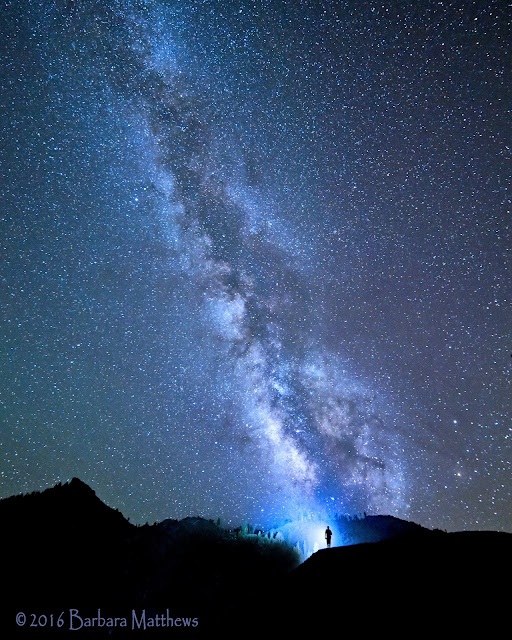
Ancient Skies Above

Endless Skies

Flash

Milky Way Over Donner

Milky Way Rising

New Moon Milky Way

Basking in the Emerald Light

The Golden Hour

Harvest Moon

2016 Harvest Moon

Harvest Moon 2016
Monday, December 14, 2015
New online storefront now open to purchase images

Update: I closed the store in 2019 and am looking for another vendor to work with.
Saturday, January 3, 2015
Happy New Year!

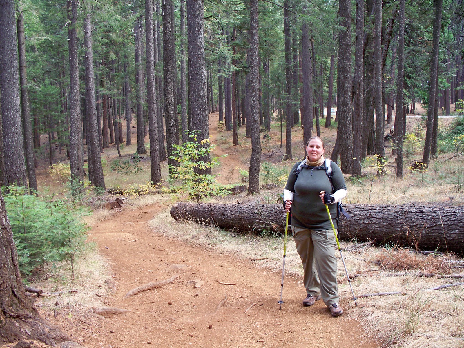
Preparations for my upcoming hike of the Appalachian Trail continue. Each day presents a list of to-do items to take care of and then the reward is getting out there and hiking. Nothing gets you ready for a backpacking trip like loading up a pack and going on training hikes. I also spend time in the gym with weights and some added cardio. I have been following a pretty specific plan to prepare for this trip because I am recovering from knee injuries and wish to prevent them in the future. It has required a very slow and steady increase of weight, distance and intensity. I try very hard to mix it up everyday so my body doesn't get used to the work out. As of this week I am now carrying a 25 lb backpack and hiking 3-10 miles.
I have received a lot of questions about trails I hike on so I thought I would post a bit about the main trails I hike for training. There are many others in the Grass Valley/ Nevada City area. One great place to start out is on one of the many Bear Yuba Land Trust trails. You can find information here http://www.bylt.org/index.php/trails/trails-page-1/
The photo above is of Cascade Canal Trail. It is basically flat and 4 1/2 miles long with a couple of short out and back trails along the way. It has been a great place to hike the first day I bump up the weight of my pack and get in a 9-10 mile hike. http://www.bylt.org/index.php/trails/trails-page-1/cascade-canal-trail-map/


Empire Mine State Historic Park is one of my favorite training grounds. The beautiful park offers a great diversity of trails, 14 miles in all. It is easy to put together whatever type of hike you need. Osborne Hill provides some elevation as well as some practice hiking up and down slippery rocks in one section. Download a trail map prior to hiking there. http://test-empiremine.org/trails

Hidden Falls Park in Auburn, CA has a maze of trails with some ups and downs and a nice views and a waterfall bonus when the water is flowing well. Download a map from their website prior to hiking there. I is easy to make a loop of whatever your distance goal of the day is. This is a great option when there is too much snow and ice on other trails. http://www.placer.ca.gov/departments/facility/parks/parks-content/parks/hidden-falls

Hirschman's Pond trail is another relatively flat trail near Nevada City that parallels highway 49. I rarely use this trail, but it is nice for a change up. http://www.bylt.org/index.php/trails/trails-page-1/hirschman-trail/
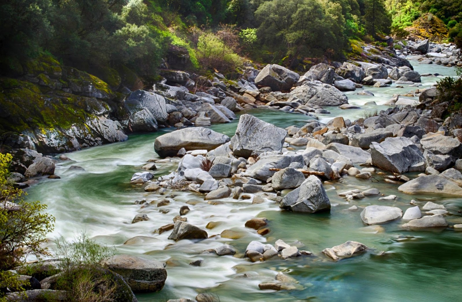
Trails along the South Yuba River State Park offer gorgeous views and often the sense of instant isolation. There are many options in this park including the Independence Trail which has a section that is accessible by wheelchair. This is a heavily infested tick area with known cases of Lyme disease so prepare for ticks and check yourself well prior to getting back in your car. Despite wearing permethrin treated clothing, staying on the trail and using DEET, I have never hiked here and not found ticks on me afterward. http://www.southyubariverstatepark.org/Web%20Pages/trails.html
Pioneer Trail is about 25 miles long and parallels highway 20 above Nevada City. It is a great place to push distance limits. It is very popular with mountain bikers so it is not the place to have both headphones in listening to music, keep and ear and eye out to avoid collisions with fast moving bikes. At times this trail is above the snowline and not easily accessible. Summer months it offers a cooler place to hike without traveling far. http://www.americantrails.org/nationalrecreationtrails/trailNRT/Pioneer-USDA03.html
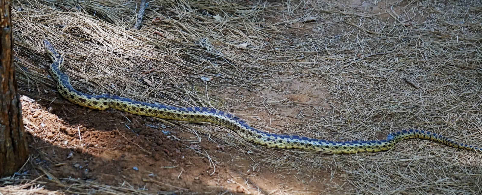
One of the gems of Grass Valley is the easily accessible Litton Trail. There are many other side trails that can be linked up to make a 5 mile loop through the woods right here in town. Despite being right in town be aware that many critters frequent the area. Mountain lions, coyotes, foxes, and snakes have all been sighted here in the last year. http://www.bylt.org/index.php/trails/trails-page-1/litton-trail/
Wednesday, November 12, 2014
My Walk in the Woods
Fall is my favorite time of year. I was lucky enough to get a few photos at
Empire Mine State Historic Park today before the incoming storm hits.
I am so fortunate to have several California State Parks nearby
and I get out and enjoy them as often as possible. Empire Mine has the
mine property and museum but also has miles of trails that are accessible for free.
It is really sort of a maze of interlocking and looping trails, none of them
very long in mileage. The various loops can be connected to
make a very nice 5 mile +/- hike through the woods.
Here is a panorama of one of the intersections,
my favorite bridge and some beautiful fall colors.
Click the photo to see full size image!

Saturday, September 27, 2014
Panoramas from along the trail
Panoramas from along the Duck Pass and John Muir Trails
Click on photo for the best view

Heading up Duck Pass
Looking back a the trail hiked and lakes visited

Duck Lake and Pika Lake
At close to 10,800 ft elevation, this lake will take your breath away

Duck Lake from the outlet
This area is closed to camping, but makes a great rest stop
before continuing on to the John Muir Trail

Sweeping views from along the John Muir Trail

Hiking through the remnants of the Rainbow Fire
heading down into Red's Meadow
Sunday, September 21, 2014
2014 John Muir Trail section hike recap
What a beautiful hike and an incredible learning experience.
As a shakedown prep hike for our AT thru-hike next year,
this hike was a success despite having to cut it short. Check out my
journal here
Here are some of my favorite scenes from along the way.

Lake Maime Sunset
A day to get acclimated

Cole heading up the Duck Pass Trail into the John Muir Wilderness

The journey up the mountain begins

Enchanted- Arrowhead Lake
A beautiful spot to stop for breakfast, just .3 miles down a side trail.
The scene quickly turned magical as the sun rose higher.

A sandy beach at Skeleton Lake

Further up the trail we got a great view of Skeleton Lake

Lunch break on the rocky shore of Barney Lake.

Resting at Barney Lake

Lunch and rest at Barney Lake before the switchbacks climbing up Duck Pass.
Hot and dry switchbacks provided little shade but stunning views of the
trail we have already traveled.

Barney Lake from above

Cole taking in the view

Up and over Duck Pass

Duck Lake and its smaller neighbor Pike Lake

Duck Lake Outlet heading toward the junction of Duck Pass Trail and John Muir Trail

A familiar scene as my son Cole takes a break while waiting for me to catch up.

Panorama of Duck Lake from the outlet
Duck Lake and smaller Pika Lake

First full day on the John Muir Trail

Incredible vistas along the JMT heading north towards Red Cones

We met several Southbound JMT thru-hikers during the day. A friendly Brit took a photo for us.

Crater Meadows area along the John Muir Trail

Yet another tortoise and the hare scene. The trail has transformed into crushed pumice, dusty and similar to walking through sand.

An old giant

One of the Red Cones

The next morning, we traversed through devastation on a scale the photos just don't show.
A windstorm with sustained winds of 150 mph tore through this area in November of 2011
snapping off and uprooting thousands of trees. Kudos to the trail crews that tackled the tremendous task of clearing the downed trees from the trail.

A few miles down the trail, the scene shifts from blow down to fire scars. The area around Red's Meadow was burned by the 1992 Rainbow Fire. There are many birds, hawks, ferns and wildflowers as evidence of the slow recovery.

Cole's home away from home- Big Agnes Copper Spur 2 and his Helinox Chair

My home away from home= Sierra Designs Lightning 2UL
Rainbow Fire Remnants

The final step. This was the end of our journey as my knees refused to ascend those stairs.
l
Subscribe to:
Posts (Atom)